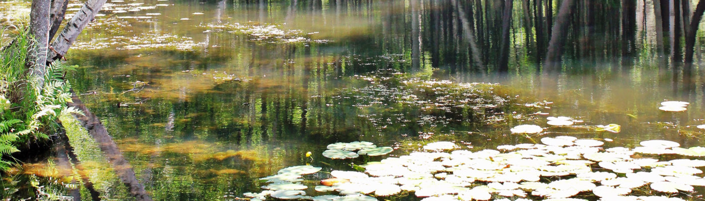
Acknowledgement: The Tomahawk Lake Association, Inc. is pleased to partner with the Michigan Shoreland Stewards Program (www.mishorelandstewards.org) and Wisconsin Healthy Lakes initiative (www.healthylakeswi.com) to pilot the Michigan Rate Your Shoreland survey tool for possible future Wisconsin statewide use.
How does the survey work?
- The Michigan Shoreland Stewards Program is a free online survey created for individual inland lake property owners to rate their management practices. There are three different levels that can be achieved, Gold, Silver and Bronze that indicate property management practices are helping to protect the lake. If a property doesn’t qualify for these a “Starter Level” will be indicated. Every property is different. Some will qualify right away, some will need some improvements and others may not be able to qualify at all. If your property does not currently qualify some suggestions for improving your score will be provided at the end. Once improvements are made the survey can be taken again.
- A personalized certificate, ability to print survey results and suggestions for improvement and upload pictures to show case a property is provided for registered participants only. There is also an option to purchase a sign for qualifying properties.
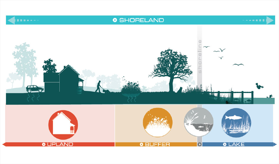
- The survey has a total of 38 questions though not everyone will be asked every question because some may not apply to a specific property. It takes approximately 30 minutes to complete. Each question has its own page with information to help you along the way. Some answers will have a “Help” button that can provide more information about that specific answer. In addition, below each question, there will be more information that will help you to understand more about the question topic.
- What Level Are you?
What Level Are You: Gold, Silver, Bronze or Starter?
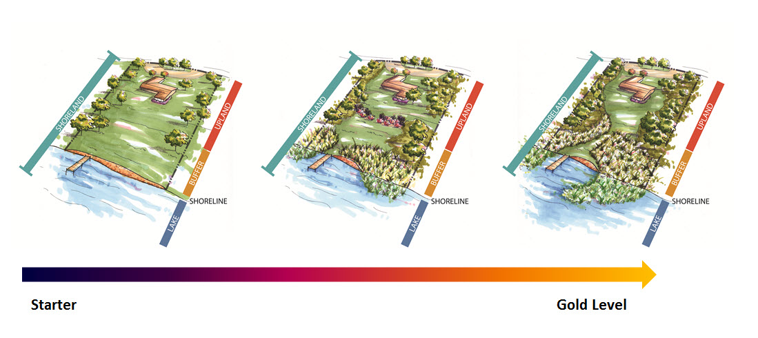
Three different levels can be achieved: Gold, Silver, Bronze. If a property doesn’t qualify for these a “Starter Level” will be indicated. The survey has an automated scoring system and the responses to the questions determine the recognition level. Practices such as maintaining high quality buffers, controlling erosion through lake friendly practices, maintaining woody structure and aquatic plants in the lake are weighted more heavily than questions such as picking up pet waste.
- GOLD: A property at this level will have the most natural of conditions with high levels of natural vegetation with very little lawn. Buildings may be difficult to see from the lake. It will not have a seawall. Aquatic plants will be in the lake (where they would naturally exist), stormwater runoff is not directly getting to the lake or causing any erosion problems. Access to the lake has been minimized.
- SILVER: A property at this level will have high levels of natural vegetation and will not have a seawall. Though there may be more lawn than at the Gold level. Stormwater runoff is not getting directly to the lake or causing erosion problems. Erosion at the shoreline is managed in a lake healthy manner. Access to the lake has been minimized.
- BRONZE: A property at this level may or may not have a seawall. If there is a seawall best management practices are being used to reduce the negative impacts of seawalls. This property will have natural vegetation but may also have more lawn than a property at the silver or gold levels. Stormwater runoff has been minimized and is not causing erosion problems. Access to the lake has been minimized.
- STARTER: Each property is different, and some may not qualify for a certificate until some management practices are improved. If your property does not currently meet the criteria to become a MI Shoreland Steward you can take the survey again after improvements are made. Make sure you save your answers, so you know which areas you can improve upon. Remember every lot size is different. Not every property will be able to qualify or reach the Gold level but everyone can do something to help your lake.
This figure illustrates the progression of a property from Starter to Gold level.
At the end of the survey you will be provided information about the level you have achieved, your answers and areas for improvement if any. If you have not yet registered this is your last opportunity to register to have your answers saved. You can also print your report and certificate if you are awarded one. If there are errors, you can clear your survey and start over. If you have made improvements you can take the survey again.
Can I save my survey answers and areas for improvement to my computer?
You can view and print your answers and areas for improvement at any time by logging in to your account. You can save your survey results to your computer by clicking on the “print this report” button at the end of your survey. Then copy and paste the report into a blank document and save.
How can I get a certificate?
A certificate is awarded for registered participants of qualifying properties only. The certificate is automatically generated at the end of the survey for all three levels. The certificate will be personalized with your name, lake name and date. The border of the certificate will indicate the level your property has achieved. You can print it at any time.
Can I save my certificate to my computer?
You can view and print your certificate at any time by logging in to your account. You are unable to save your certificate to your computer at this time.
How can I purchase a sign?
A sign can be purchased for those qualifying properties and interested property owners. These can be placed in your yard or other location of your choice. There are 3 sizes to choose from and each comes with pre-drilled holes.
Material: .080″ aluminum panel
Decorated with a digital print with UV laminate.
Border Color: There are 3 different border colors: Gold, Silver and Bronze to correspond to your specific level.
The MNSP must work through its partners to make signs available for purchase. At this time there are two options available.
Option 1: This option provides signs with only the MNSP Logo. They are available for purchase through Michigan Lake and Stream Associations.
All prices include shipping and handling. Please allow 4-6 weeks for delivery.
1. Size: 12″ x 6″ with 2 holes drilled Cost: $20
2. Size: 16″ x 8″ with 4 holes drilled Cost: $28
3. Size: 24″ x 12″ with 4 holes drilled Cost: $38